Our Rich Past Led to a Bright Future
Related pictures can be seen in the Photo Gallery.
Explore these time periods:
- From the beginning to 1900: Pioneering the Land
- 1900 to 1950: Farming the Land
- 1950 to Present: Naming the Land
From the beginning to 1900: Pioneering the Land
It was the land – a long, narrow strip of post oak and blackjack oak forest teeming with wild game known as the Eastern Cross Timbers and prairie grasslands that lay on either side – that enticed people to what is now Southlake.
Early Indian tribes in the area are thought to include Tonkawas and the Hasinai Caddos. By the late 1700s the Comanches, Kiowas and Wichitas had moved into the region. They and others moved in and out of the Cross Timbers, skirmishing with each other and the Spaniards, who were establishing missions and searching for settlement sites. According to Southlake Historical Society historian Jack Wiesman in his book, “An Historical Perspective of Southlake,” soldiers such as Captain Don Ramon traveled north from Mexico through the Hill Country only to face the dense Eastern Cross Timbers forest. Ramon noted that after hacking his way through the “monte grande,” he was weary and grateful to reach a clearing but that he had lost two knives in the effort.
“The word ‘Indian’ or the phrase ‘Native American’ does not do justice to the diversity and complexity of the traditional native peoples of Texas,” writes David LaVere in “Life Among the Texas Indians, the WPA Narratives.” He quotes Charles R. Hume, a government physician to Indians around Anadarko, Okla., who said 1892 that there were two types of Indians, “the Plains Indians and the Timber Indians. The Plains Indians roamed the plains hunting buffalo and such. The Timber Indians have always cultivated their lands, raising mostly corn. The Kiowas, Comanches and Apaches are Plains Indians, while the Wichitas and the Caddos are Timber Indians.”
Theirs wasn’t a hand-to-mouth existence, notes Jill Falcon Ramaker, an assistant professor of sustaninable food systems. Tribes possessed a “knowledge of a vast landscape, including an intimate understanding of animals, plants, season, and climate, passed down for millennia and retained as a matter of life and death.”
Each group, Mr. LaVere writes, “saw themselves as the center of the universe and each possessed their own unique way of providing food for themselves, building houses, dressing, marrying, burying and grieving for their dead, and worshipping the Creator.”
From the mid-1800s on, white settlers were enticed to North Texas, wooed by land grants and a chance to start over. The very things offered by the land – forest, water and game – were what they were searching for. Families traveled from Missouri, Tennessee and other Southern states and stopped to make a home here; using logs, they built their houses and churches, including Lonesome Dove Baptist Church in the late 1840s and White’s Chapel Methodist Church in the early 1870s.
They tilled the fertile prairie land, and more and more families arrived. As they staked their claims, it was inevitable that clashes with the Indians would result. (Due to a treaty noted below, there were few Indian problems in now-Southlake, although settlers kept a watchful eye out for Indians.)
One well-known Indian raid in North Texas was the 1836 Comanche attack on Parker’s Fort, 30 miles west of Waco. Some settlers were killed but others escaped, including 16-year-old Malinda Frost Dwight, her first husband, their baby daughter and mother. (In 1870, Malinda Frost Dwight Hill was buried by her sons in Lonesome Dove Cemetery.) Captured at Parker’s Fort was Cynthia Ann Parker, who remained with the Indians for almost 25 years until Texas Rangers returned her to her white family. Isaac Parker, her uncle, brought her to Birdville, Texas, and tried to resettle her on his farm, but she never was able to return to the white man’s world. (See Isaac Parker’s cabin at the Log Cabin Village in Fort Worth.)
During the infancy of the Republic of Texas, Indian treaties were agreed to; most notable were those efforts made by President Sam Houston, who worked to set boundaries between the white settlers and the Indians. Several treaty meetings were held very close to now-Southlake. While waiting for various tribes to arrive for one treaty signing, Houston and his entourage camped for a month at Grapevine Springs (in present-day Coppell), where they hunted buffalo. The chiefs never arrived and the meeting was rescheduled. The treaty later was signed at Bird’s Fort, and as a result the Eastern Cross Timbers became the demarcation line in 1844 between Indians and white settlers (problems were few in now-Southlake, but settlers going into Parker, Wise and other counties to the west had major Indian troubles). “This region was indeed the untamed West,” author Janet Schmelzer writes in her book, “Where the West Begins.”
In 1847, Hall Medlin, a Lonesome Dove Baptist Church deacon, was gored by a buffalo and almost died. The buffalo is said to be the last one killed in this area. The Medlin family cemetery, inside present-day Trophy Club, serves as a reminder of those early settlers. (Learn more about early settlers in the “Missouri Colonists” section.)
By 1853, a small fort named Fort Worth protected the border to the west, but the U.S. Army was ordered to move farther west. The Texas Legislature authorized the U.S. government to select land for Indian reservations inside Texas, and the last treaty made with the Comanche was signed in 1867. Some reports make clear that Texans never took the treaties seriously. Likewise, tribes would not stay on the land allotted them. Settlers continued to move into Texas searching for a place to call home, and the demarcation boundary was pushed farther west. The small, settled communities left behind – Dove, White’s Chapel, Old Union – came together in 1956 as a town called Southlake.
– By Connie Cooley, Southlake Historical Society
1900 to 1950: Farming the Land
Give it some water, the saying goes, and it will grow.
And boy, did it.
Yet, “in the beginning,” remembered longtime resident Mabel M. Cate in an oral history, “it wasn’t Southlake. It was just a mail route out of Grapevine and [in] no one’s city limits. Just country.”
Until the mid-1900s, the area west of Grapevine was a collection of rural farming communities: Dove, White’s Chapel, Old Union. Originally, each community centered on its school, and families identified with the community they lived closest to. Some communities also included a church and, over the years, maybe a store, a cotton gin or a blacksmith shop.
Life was slower.
“You didn’t go like we do now,” said Elizabeth Higgins in an oral history. “You visited your neighbors and children would get together, but it was a different world altogether to what it is now.”
Telephone service reached White’s Chapel and other communities around 1900, although some in the area didn’t have telephones until much later. In 1939, the REA extended power lines into the area.
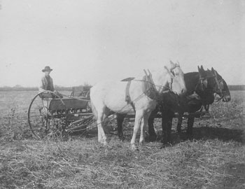
Farmers grew cotton, corn and grain and raised livestock. Housework included endless cooking, canning, floor-scrubbing, baby-tending and more. Most families had a milk cow, chickens and hogs; everyone had a big garden.
During World War I, young men from now-Southlake left to fight in France. Over Grapevine, amazed onlookers watched airplanes on practice runs from a military base in Fort Worth. The Spanish influenza that swept the world struck here, too; one of its victims, Walter Torian, is buried at White’s Chapel Cemetery.
News was hard to come by. “Out here in the country . . . you’d get two papers a week, and that’s what you’d get,” remembered Mrs. Higgins. “You didn’t have radios and you didn’t have television. First connection we had was a little crystal-set radio. Then we got a lot of news over that when it’d come in, but that was after the [First World] war.”
In 1917, Dove, White’s Chapel, Union and the eastern portion of Sams were consolidated. The brick school building that replaced those “one-roomers” still stands, next to Carroll Intermediate School. Carroll School was built in 1919.
Everyone went to church. At some churches, youths would meet on Sunday nights. Families would gather at various times for fellowship and fun. At White’s Chapel, Myrtle Austin Carleton remembered in the book “Grapevine Area History”: “All of the people, all of the time, not some of the people, worked to build a better church and community.”
In the summer, revivals were held in a brush arbor – poles with leafy branches spread on top – constructed on the church grounds. It was at one such revival, at Lonesome Dove Baptist Church, that Clarence Long was converted and then baptized in the Dove Branch along with about 30 others. At revivals, people would often “get happy and shout” – what Mr. Long, in an oral history, called “old-time religion.”
On Saturday nights, downtown Grapevine was the place to be. “The town would be full of people on Saturday night – of country folks coming to town, and city folks getting together and meeting and talking over, telling jokes, and having a good time. That was the highlight of the week,” remembered J.T. Davis in an oral history.
Other times, “the boys and girls and the mothers and daddies would give parties, and they was real chaperoned,” Mrs. Higgins remembered. “And we had a lot of fun that’a way.”
The Depression was hard on the now-Southlake area, but people “didn’t suffer,” Mr. Long said, because they could raise most of what they needed to eat and could barter for other things.
Texas 114, completed in 1932, was a boon to the area. One service station along 114 in now-Southlake was run by Felix Torian, whose nickname was Man. He had come by wagon from Kentucky in the 1870s and first ran a service station in Grapevine at Main and Texas streets (next door, coincidentally, to where the Torian log cabin would be moved in the mid-1970s by the Grapevine Historical Society and restored). But “city life was not for Man Torian,” his nephew wrote in “Grapevine Area History,” “so in less than three years, he moved his station 3½ miles northwest of Grapevine on what was then the new Highway 114.” He ran the station until his death in 1945.
The intersection of Texas 114 and Dove Road was the site of the shooting on Easter Sunday 1934 of two highway patrol officers by Bonnie and Clyde or a member of their gang. E.B. Wheeler and H.D. Murphy had stopped because they thought the outlaws were motorists in need of assistance. One of the officers was about to be married; his bride-to-be wore her wedding outfit to his funeral. A monument now stands near where they were murdered.
During WWII, young men from west of Grapevine again left to serve their country. Afterward, as happened all over the country, some young men and women moved to the city. But many families with deep roots in the community remained. Family names still heard around town include Tate, Chivers, Cook and McPherson.
In a racially divided Texas, the Bob Jones family was well respected in the area. Bob and Almeady Jones, each of whom had a white father and a mother who had been a slave, reared 10 children on their ranch near Roanoke. In 1949, sons Jinks and Emory opened a livestock sales barn at Texas 114 and White’s Chapel; adjacent to it was a tiny café run by their wives, Eula and Elnora, in which black truckers and white ranchers and farmers sat side-by-side to eat chili, stew and red beans. It is thought to be the first integrated cafe in Texas.
In 1945, the U.S. government authorized a lake that would tame Denton Creek (which overflowed each spring), provide recreation and supply water to cities. By the mid-’40s, the government began buying up and then condemning land needed for the lake – some 12,000 acres. “Dairy farms and truck or produce farms were where the lake is now,” Mrs. Cate recalled. Some people were angry and suspicious of the process. “It was a sad time because they had no choice,” she remembered. “It was ‘progress,’ we were told.” The Army Corps of Engineers completed Lake Grapevine in 1952.
With the lake, the area west of Grapevine began to attract newcomers. And just over the horizon, another big change was in store for the area that would soon be called Southlake.
– By Anita Robeson, Southlake Historical Society
A version of this article appeared in the Southlake Journal’s special section on Southlake’s 50th birthday, 2006.
1950 to Present: Naming the Land
One summer evening in the late ‘50s, Bruce McCombs, then 16 or 17 years old, got the urge to drive the family car to Keller on Grapevine-Keller Road (now known as Southlake Boulevard). “I drove to Keller and back,” he recalled, still unbelieving after all these years, “and did not see ONE CAR.”
How things have changed.
Today, Southlake encompasses 22 square miles and is home to nearly 25,000 people. At its beginning, in 1956, about 200 residents lived within its boundaries of 1.62 square miles.
Back in the early ’50s, “downtown” was the intersection of Carroll Avenue and Texas 114, where the town’s first stoplight was hung. On one corner sat a long building with a gasoline pump out front. Inside was a small grocery and café. North across 114 was Casey’s Grocery, where town business was done before City Hall was built. Farther north, toward Highland Avenue, was the hub of the community, Carroll School.
“[The school was] where everything took place,” recalled Mable M. Cate in an oral history. That included the special election on whether to incorporate as the Town of Southlake.
Old-timers say they would have been content to stay rural, free of city taxes and controls. If Hurst hadn’t begun making noise about annexing unincorporated land, there would not have been a petition and a vote – at least, not for a while.
“I don’t think that there’s any of us that lived here that were very excited about being Southlake,” Mrs. Cate explained. “I wasn’t. We just didn’t want to be Hurst. But they were coming right down the road after us.”
When the votes were counted, 30 people had voted for incorporation and 24 against (some people didn’t believe Hurst would annex). A. Gail Eubanks was elected mayor. City leaders chose the name Southlake, which had been suggested by Mayor Eubanks’ daughter Suzanne.
Southlake wasn’t the only town that moved fast. Colleyville and Westlake also incorporated in 1956. Grapevine would have been the logical choice to annex what’s now Southlake – and a number of residents were interested in becoming part of Grapevine – but Grapevine was not eligible to annex.
Even after Carroll School expanded to 12 grades (a high-school grade was added each year, starting in 1961), some Southlake families continued sending their children to Grapevine High.
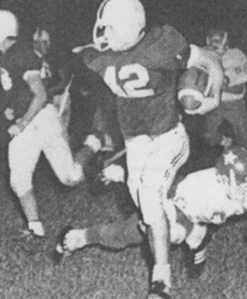
And then there was football. The Dragons got the ball rolling in 1965 by winning a district football championship. (Although it would be a few years before they scored another.)
That also was the year that something big landed on Southlake’s doorstep: a major international airport.
Work toward a regional airport had begun in 1940 at a meeting in Wichita Falls of the Texas Aeronautics Advisory Committee and the Civil Aeronautics Board. But who should get the airport, Dallas or Fort Worth? After years of wrangling, an agreement was reached in 1965 that placed the airport between the two cities; an engineering firm recommended that it be built along the Tarrant-Dallas county lines near Grapevine. In 1974, the Dallas-Fort Worth Regional (later International) Airport opened for business. For citizens of Southlake, economic benefits would follow, but so would problems associated with noise, runway proximity, air pollution and traffic.
All the while, thanks to the increasing prosperity and mobility in North Texas, Southlake was growing. A town planning board was formed in 1964. A water system consisting of a well, a 500,000-gallon storage tank and a distribution system was put in place.
In 1965, Southlake upgraded to a city. An all-volunteer fire department was formed in 1966. To raise $250 to buy a 1950 Diamond-T military unit pumper truck with a 1,000-gallon tank, the mayor sold Christmas trees at the corner of Carroll and Texas 114. In 1966, a police department replaced the town marshal. A junior fire department made up of 16- to 18-year-old boys was organized in 1972 to assist the fire department.
In 1968, city leaders adopted a comprehensive land-use plan, which cost $6,000 and was paid for by contributions from citizens and several utility companies. That year, ground was broken for the airport.
In the 1970s, with the assistance of the county, streets and roads were improved. Some streets were renamed, and street signs were placed throughout the city. The city built its first park with three baseball diamonds and two tennis courts. From the early days, the hill within the park was called Bunker Hill, and history shows that wagon trains heading west camped on an adjacent flat area called Blossom Prairie. The park, dedicated in 1976, was named Bicentennial Park.
FM 1709, also known as Southlake Boulevard, was a two-lane, hilly, rutted affair. In 1985, city leaders went to Austin to petition for help in making improvements. After several tragic car accidents on the road, the state was convinced it needed upgrading. Major improvements were made in the early ‘90s.
Home Rule Charter passed in 1987 allowing Southlake to each year annex land equal to 10 percent of its size. In 1988, the city signed an interlocal agreement with the Trinity River Authority that allowed for municipal sanitary sewer. Fort Worth was lined up to provide water.
With infrastructure coming into place, Southlake was poised for change.
“We had a blank canvas,” remembered Gary Fickes, who was elected to the city council in 1985 and served as mayor from 1989-1996. (He and others familiar with Southlake over the years appeared at a SPIN forum on city history; watch the program by clicking on the Photo & Video Gallery.)
“The council and the community had an opportunity to paint it the way they thought best,” he said. Solana had set the tone for quality, and many projects brought to the city for approval were turned down. Because land costs were rising, more expensive homes were being built.
To protect the quality of life and to set high standards, all of the land in town was rezoned. The reason, explained Mr. Fickes, had to do with many instances of incompatible land use, such as property zoned industrial being next to homes.
The Planned Unit Development, or PUD, concept allowed developers to use their land most effectively when planning where to place homes. Developers were also encouraged to add amenities such as community swimming pools, tennis courts, parkland, etc. Timarron, which grew up in the ‘90s, was the first true master-planned subdivision in Southlake. Today, Southlake has more than 60 subdivisions.
Since the late 1980s, the city has reached these population milestones: 5,000 residents in 1987; 10,000 in 1993; 20,000 in 1998; and about 25,000 today. At build-out, the population is expected to be about 30,000.
To better serve a growing community, the police, fire and communications departments were combined in 1990 into the Department of Public Safety. Today, the department includes fire, police, support services and code enforcement.
Other city services that expanded or were created because of the city’s growth include economic development, parks (the system now includes 10) and public works. SPIN was formed in 1994 to keep residents informed.
By the 1990s, lots of people were moving in and businesses were popping up along Southlake Boulevard, but something was missing: a downtown. In 1996, the firm of Cooper and Stebbins approached the city with a bold shopping-center concept called Town Square. The city and the developer worked long and hard to make it a reality.
The first phase of Town Square opened in 1999. Its centerpiece, Town Hall, became home to city offices previously located in the fire station building on Carroll Avenue, as well as to Southlake’s library (residents had been borrowing books from Grapevine). Town Square’s second and third phases opened in 2006.
Today, commercial and residential growth continues in a big way. But it’s the people, not the growth, that made the city what it is. It’s the people who walked incorporation petitions door to door in 1956. They’re the ones who over the years have attended innumerable meetings of the city council and of citizen’s advisory groups, coming together to voice both suggestions and concerns.
It’s the teachers and school board members and volunteers who formed an exemplary school district from a small school that got no respect. And it’s old friends and new who helped and encouraged one another, whether at church, in their neighborhoods or through the chamber of commerce or various civic clubs.
Ask anyone who’s lived in Southlake for more than a few decades, and he or she will tell you it was the people who made Southlake. And that continues today.
Some things never change.
– By Anita Robeson and Connie Cooley, Southlake Historical Society
A version of this article appeared in the Southlake Journal’s special section on Southlake’s 50th birthday, 2006.